Live briefing

Everything about World map
Map of most or all of the surface of the Earth
A world map is a map of most or all of the surface of Earth. World maps, because of their scale, must deal with the problem of projection. Maps rendered in two dimensions by necessity distort the display of the three-dimensional surface of the Earth. While this is true of any map, these distortions reach extremes in a world map. Many techniques have been developed to present world maps that address diverse technical and aesthetic goals. Wikipedia →
🧭 Start here: a 6-step reading path
- Read the overview: World mapA 5-minute orientation
- Pick up a classic book: World-maps for finding the direction and distance to MeccaThe most-reprinted book on the subject
- Read the landmark paper: WorldMap – a geospatial framework for collaborative researchCited 22 times
- Go sideways: Map projectionA closely related topic
- Go sideways: CartographyA closely related topic
📖 Definitions
No dictionary entry for this exact phrase.
🗂️ The subject at a glance
🏆 Landmark papers (most cited)
WorldMap – a geospatial framework for collaborative research
Online Survey of Heterogeneous Users and Their Usage of the Interactive Mapping Platform WorldMap
A Study: Using WORLDMAP: Of Distributions of African Savanna Plants
The representation of the north of Europe in the Worldmap of Petrus Plancius of 1592
The WORLDMAP debate
Understanding Today's Online GIS User Through the Lens of a WorldMap Survey
Using the Worldmap PC program for measuring biodiversity in order to choose prioritized conservation areas in southern Africa
Notes on the Worldmap in “Rudimentum Novitiorum”
📚 Books worth reading
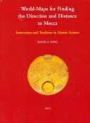 World-maps for finding the direction and distance to MeccaDavid A. King · 1999
- 📕Robinson Portrait (Worldmap) · 1993
- 📕Ordnance Survey World Maps (Worldmaps / Ordnance Survey)Ordnance Survey · 1991
- 📕AGL/WORLDMAPS user guide and reference manualUniras (firm) · 1992
- 📕Uniras AGL/WORLDMAPS user guide and reference manualUniras (firm) · 1989
- 📕UNIRAS version 6 · 1989
- 📕Father Matteo Ricci's Chinese world-maps, 1584-1608John F. Baddeley · 1917
 Map of the World/Map of United States · 2000
Ranked by number of editions on Open Library, a rough measure of how lasting a book is.
🔗 Related topics
- Map projection In cartography, a map projection is any of a broad set of transformations employed to represent the curved two-dimensional surface of a globe on a plane…
- Cartography Cartography (/kɑːrˈtɒɡrəfi/) is the study and practice of making and using maps. Combining science, aesthetics and technique, cartography builds on the…
- Equal Earth projection The Equal Earth map projection is an equal-area pseudocylindrical global map projection invented by Bojan Šavrič, Bernhard Jenny, and Tom Patterson in…
- Gall–Peters projection The Gall–Peters projection is a rectangular, equal-area map projection. Like all equal-area projections, it distorts most shapes. It is a cylindrical equal-area…
- Map In cartography, a map is a representation or abstraction of geographic reality. Maps are used for a wide range of purposes, including navigation, scientific…
- Mercator projection The Mercator projection (/mərˈkeɪtər/) is a conformal cylindrical map projection first presented by Flemish geographer and mapmaker Gerardus Mercator in…
- Critical cartography Critical cartography is a set of cartography practices and methods of analysis grounded in critical theory. It is based specifically on the thesis that…
- Dymaxion map The Dymaxion map projection, also called the Fuller projection, is a kind of polyhedral map projection of the Earth's surface onto the unfolded net of…