Everything about Map
Symbolic depiction of spatial relationships

In cartography, a map is a representation or abstraction of geographic reality. Maps are used for a wide range of purposes, including navigation, scientific research, governance, and warfare. A common use is route planning, which enables users to find their way to their destination. Specialized maps called charts are used for nautical navigation and aviation. Scientists use maps to organize spatial data in fields such as geology, meteorology, seismology and demographics. Governments use maps for administrative functions such as census, electoral districts, property taxation, dispatching police, and coordinating disaster relief. Military and security organizations use maps for mission planning, surveillance, border management, logistics, and intelligence analysis. Wikipedia →
🧭 Start here: a 6-step reading path
- Read the overview: MapA 5-minute orientation
- Skim a recent paper: A genomic mutational constraint map using variation in 76,156 human genomesInfluential work since 2022
- Pick up a classic book: A Study of HistoryThe most-reprinted book on the subject
- Read the landmark paper: The Sequence Alignment/Map format and SAMtoolsCited 61,847 times
- Go sideways: Cynthia BrewerA closely related topic
- Go sideways: CartographyA closely related topic
📖 Definitions
Symbol ISO 639-2 & ISO 639-5 language code for Austronesian languages.
Noun A visual representation of an area, whether real or imaginary, showing the relative positions of places and other features.
Noun A graphical or logical representation of any structure or system, showing the positions of or relationships between its components.
Noun A function, especially a function satisfying a certain property (e.g. continuity, linearity, etc.; see Usage notes).
🏆 Landmark papers (most cited)
The Sequence Alignment/Map format and SAMtools
Tissue-based map of the human proteome
World Map of the Köppen-Geiger climate classification updated
Updated world map of the Köppen-Geiger climate classification
A 3D Map of the Human Genome at Kilobase Resolution Reveals Principles of Chromatin Looping
Köppen's climate classification map for Brazil
Terrestrial Ecoregions of the World: A New Map of Life on Earth
An integrated map of genetic variation from 1,092 human genomes
🆕 Influential since 2022
A genomic mutational constraint map using variation in 76,156 human genomes
A saturated map of common genetic variants associated with human height
Spatial multi-omic map of human myocardial infarction
A 30 m global map of elevation with forests and buildings removed
The present and future of the Cancer Dependency Map
📚 Books worth reading
 A Study of HistoryArnold J. Toynbee · 1900
- 📕Land Capability For Wildlife-WaterfowlCanada Land Inventory. · 1968
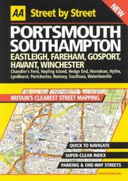 AA Street by StreetAA Publishing · 1995
 Knopf MapGuideKnopf Guides · 2003
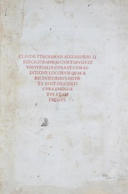 GeographiaPtolemy · 1478
 Tour thro' the whole island of Great BritainDaniel Defoe · 1724
 Rand McNally StreetfinderRand McNally · 1986
 Human GeographyHarm J.De Blij · 1982
Ranked by number of editions on Open Library, a rough measure of how lasting a book is.
🔗 Related topics
- Cynthia Brewer Cynthia Ann Brewer (born 1960) is an American cartographer, author, and professor of geography at Pennsylvania State University. Brewer's specialty relates…
- Cartography Cartography (/kɑːrˈtɒɡrəfi/) is the study and practice of making and using maps. Combining science, aesthetics and technique, cartography builds on the…
- Web GIS Web GIS, also known as Web-based GIS, are Geographic Information Systems (GIS) that employ the World Wide Web (the Web) to facilitate the storage, visualization…
- Arthur H. Robinson Arthur H. Robinson (January 5, 1915 – October 10, 2004) was an American geographer and cartographer, who was a professor in the Geography Department at…
- Cartographic propaganda Cartographic propaganda is a map created with the goal of achieving a result similar to traditional propaganda. The map can be outright falsified, or created…
- Internet GIS Internet GIS is broad set of technologies and applications that employ the Internet to access, analyze, visualize, and distribute spatial data via geographic…
- Mark Monmonier Mark Stephen Monmonier[pronunciation?] (born February 2, 1943) is a Distinguished Professor of Geography and the Environment at the Maxwell School of Citizenshi…
- Critical cartography Critical cartography is a set of cartography practices and methods of analysis grounded in critical theory. It is based specifically on the thesis that…