Everything about Map projection
Systematic representation of the surface of a sphere or ellipsoid onto a plane

In cartography, a map projection is any of a broad set of transformations employed to represent the curved two-dimensional surface of a globe on a plane. In a map projection, coordinates, often expressed as latitude and longitude, of locations from the surface of the globe are transformed to coordinates on a plane. Projection is a necessary step in creating a two-dimensional map and is one of the essential elements of cartography. Wikipedia →
🧭 Start here: a 6-step reading path
- Read the overview: Map projectionA 5-minute orientation
- Skim a recent paper: The Human Pangenome Project: a global resource to map genomic diversityInfluential work since 2022
- Pick up a classic book: GeodesyThe most-reprinted book on the subject
- Read the landmark paper: UMAP: Uniform Manifold Approximation and ProjectionCited 10,683 times
- Go sideways: Mercator projectionA closely related topic
- Go sideways: Conformal map projectionA closely related topic
📖 Definitions
Noun Any systematic method of transforming the spherical representation of parallels, meridians and geographic features of the Earth's surface to a nonspherical surface, usually a plane.
🏆 Landmark papers (most cited)
UMAP: Uniform Manifold Approximation and Projection
The Equal Earth map projection
Symbolization of Map Projection Distortion: A Review
Projection Wizard – An Online Map Projection Selection Tool
A Knowledge Base for Map Projection Selection
An Innovative World Map Projection
The Perspective Map Projection of the Earth
A Conformal Map Projection for the Americas
🆕 Influential since 2022
The Human Pangenome Project: a global resource to map genomic diversity
Inventive problem-solving map of innovative carbon emission strategies for solar energy-based transportation investment projects
A Study of Projection-Based Attentive Spatial–Temporal Map for Remote Photoplethysmography Measurement
Dual U-Net based feature map algorithm for automatic projection alignment of synchrotron nano-CT
Panoramic Sea-Ice Map Construction for Polar Navigation Based on Multi-Perspective Images Projection and Camera Poses Rectification
📚 Books worth reading
 GeodesyU.S. Coast and Geodetic Survey. · 1900
 An introduction to the study of map projectionsJ. A. Steers · 1927
 An introduction to mapwork and practical geographyJohn Bygott · 1934
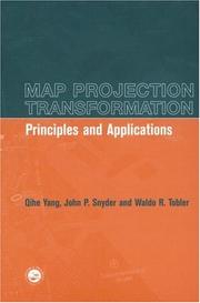 Map projection transformationQihe H. Yang, Qihe Yang · 1999
- 📕Small-Scale Map Projection DesignFrank Canters · 2002
 Physical fitnessBud Getchell · 1976
 The philosophy of fine artGeorg Wilhelm Friedrich Hegel · 1920
 CartographyU.S. Coast and Geodetic Survey. · 1918
Ranked by number of editions on Open Library, a rough measure of how lasting a book is.
🔗 Related topics
- Mercator projection The Mercator projection (/mərˈkeɪtər/) is a conformal cylindrical map projection first presented by Flemish geographer and mapmaker Gerardus Mercator in…
- Conformal map projection In cartography, a conformal map projection is one in which every angle between two curves that cross each other on Earth (a sphere or an ellipsoid) is…
- Tissot's indicatrix In cartography, a Tissot's indicatrix (English: /tiːˈsoʊ/, French: [tiso]; plural: "Tissot's indicatrices"), or Tissot indicatrix, Tissot's ellipse, Tissot…
- Scale (map) The scale of a map is the ratio of a distance on the map to the corresponding distance on the ground. This simple concept is complicated by the curvature…
- List of map projections This is a summary of map projections that have articles of their own on Wikipedia or that are otherwise notable. Because there is no limit to the number…
- Transverse Mercator projection The transverse Mercator projection (TM) is an adaptation of the standard Mercator projection for transverse aspect. The TM is widely used in national and…
- Central cylindrical projection The central cylindrical projection is a perspective cylindrical map projection. It corresponds to projecting the Earth's surface onto a cylinder tangent…
- Map projection of the triaxial ellipsoid In geodesy, a map projection of the triaxial ellipsoid maps Earth or some other astronomical body modeled as a triaxial ellipsoid to the plane. Such a…