Live briefing

Everything about Mobile mapping
Process of collecting geospatial data from a mobile vehicle
Mobile mapping is the process of collecting geospatial data from a mobile vehicle, typically fitted with a range of GNSS, photogrammetric, radar, lidar or any number of remote sensing systems. Such systems are composed of an integrated array of time synchronised navigation sensors and imaging sensors mounted on a mobile platform. The primary output from such systems include GIS data, digital maps, and georeferenced images and video. Wikipedia →
🧭 Start here: a 6-step reading path
- Read the overview: Mobile mappingA 5-minute orientation
- Skim a recent paper: Gas source localization and mapping with mobile robots: A reviewInfluential work since 2022
- Pick up a classic book: Advances in Mobile Mapping TechnologyThe most-reprinted book on the subject
- Read the landmark paper: Dynamic population mapping using mobile phone dataCited 780 times
- Go sideways: 3D city modelA closely related topic
- Go sideways: Digital elevation modelA closely related topic
📖 Definitions
No dictionary entry for this exact phrase.
🗂️ The subject at a glance
🏆 Landmark papers (most cited)
Dynamic population mapping using mobile phone data
Adaptive Mobile Robot Navigation and Mapping
Bibliometric mapping of mobile learning
Semantic Mapping Using Mobile Robots
Mobile indoor mapping technologies: A review
Mobile robot mapping in populated environments
Three-Dimensional Mobile Mapping of Caves
Real-Time Mobile 3D Temperature Mapping
🆕 Influential since 2022
Gas source localization and mapping with mobile robots: A review
A Review of Mobile Mapping Systems: From Sensors to Applications
Systematic Mapping Literature Review of Mobile Robotics Competitions
Collaborative Mobile Robotics for Semantic Mapping: A Survey
A systematic mapping framework for backpack mobile mapping system in common monotonous environments
📚 Books worth reading
 Advances in Mobile Mapping TechnologyJonathan Li · 2007
- 📕Women and Cartography in the Progressive EraChristina E. Dando · 2017
 Map-based mobile servicesLiqiu Meng · 2005
- 📕Sites perception and the nonvisual experienceAnn Middleton Kidwell · 1973
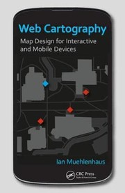 Web CartographyIan Muehlenhaus · 2013
 Environment learning for indoor mobile robotsJuan Andrade-Cetto, Alberto Sanfeliu · 2006
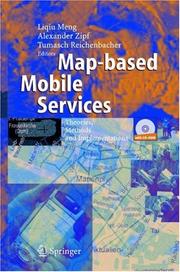 Map-based mobile servicesLiqiu Meng, Tumasch Reichenbacher · 2004
- 📕Niewidzialna mapa Wrocławia = · 2006
Ranked by number of editions on Open Library, a rough measure of how lasting a book is.
🔗 Related topics
- 3D city model A 3D city model is digital model of urban areas that represent terrain surfaces, sites, buildings, vegetation, infrastructure and landscape elements in…
- Digital elevation model A digital elevation model (DEM) or digital surface model (DSM) is a 3D computer graphics representation of elevation data to represent terrain or overlaying…
- Sisi Zlatanova Sisi Zlatanova is a Bulgarian/Dutch researcher in geospatial data, geographic information systems, and 3D modeling. She works as a professor in the faculty…
- Image analysis Image analysis or imagery analysis is the extraction of meaningful information from images; mainly from digital images by means of digital image processing…
- Georeferencing Georeferencing or georegistration is a type of coordinate transformation that binds a digital raster image or vector database that represents a geographic…
- Map In cartography, a map is a representation or abstraction of geographic reality. Maps are used for a wide range of purposes, including navigation, scientific…
- Remote sensing software A remote sensing software is a software application that processes remote sensing data. Remote sensing applications are similar to graphics software, but…
- Digital outcrop model A digital outcrop model (DOM), also called a virtual outcrop model, is a digital 3D representation of the outcrop surface, mostly in a form of textured…