Live briefing
Everything about Remote sensing software
Type of software application
A remote sensing software is a software application that processes remote sensing data. Remote sensing applications are similar to graphics software, but they enable generating geographic information from satellite and airborne sensor data. Remote sensing applications read specialized file formats that contain sensor image data, georeferencing information, and sensor metadata. Some of the more popular remote sensing file formats include: GeoTIFF, NITF, JPEG 2000, ECW, MrSID, HDF, and NetCDF. Wikipedia →
🧭 Start here: a 6-step reading path
- Read the overview: Remote sensing softwareA 5-minute orientation
- Skim a recent paper: Advanced Plant Phenotyping: Unmanned Aerial Vehicle Remote Sensing and CimageA Software Technology for Precision Crop Growth MonitoringInfluential work since 2022
- Pick up a classic book: Open source GISThe most-reprinted book on the subject
- Read the landmark paper: The Remote Sensing and GIS Software Library (RSGISLib)Cited 94 times
- Go sideways: Geographic information system softwareA closely related topic
- Go sideways: Geographic information systemA closely related topic
📖 Definitions
No dictionary entry for this exact phrase.
🗂️ The subject at a glance
🏆 Landmark papers (most cited)
The Remote Sensing and GIS Software Library (RSGISLib)
Software to facilitate remote sensing data access for disease early warning systems
Automating reuse of software for expert system analysis of remote sensing data
Big data and remote sensing: A new software of ingestion
Development of Remote Sensing Software Based on Hyperspectral Imaging Framework
Planetamonitoring Software Complex in Applied Remote Sensing Problems
Remote sensing and GIs for ecologists: using open source software
Remote Sensing and GIS for Ecologists: Using Open Source Software
🆕 Influential since 2022
Advanced Plant Phenotyping: Unmanned Aerial Vehicle Remote Sensing and CimageA Software Technology for Precision Crop Growth Monitoring
Advancing forest fragmentation analysis: a systematic review of evolving spatial metrics, software platforms, and remote sensing innovations
Analysis and Evaluation of Ecological Environment Monitoring Based on PIE Remote Sensing Image Processing Software
Superresolution Reconstruction Method of Software Remote Sensing Image Based on Convolutional Neural Network
Software for Mapping and Extraction of Building Land Remote Sensing Data Based on BIM and Sensor Technology
📚 Books worth reading
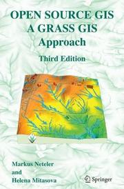 Open source GISMarkus Neteler, Helena Mitasova · 2002
 Geo-Informatics in Resource Management and Sustainable EcosystemFuling Bian, Yichun Xie · 2013
 Deep Learning for Remote Sensing Images with Open Source SoftwareRémi Cresson · 2020
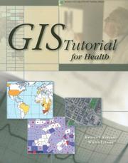 GIS tutorial for healthKristen Seamens Kurland, Wilpen L. Gorr · 2006
- 📕Learning GIS Using Open Source SoftwareKakoli Saha, Yngve K. øyen · 2021
 Remote Sensing and GIS for EcologistsMartin Wegmann, Benjamin Leutner · 2016
- 📕Spatial MathematicsSandra Lach Arlinghaus, Joseph J. Kerski · 2013
 Mapping, Monitoring, and Modeling Land and Water ResourcesPravat Kumar Shit, Pulakesh Das · 2021
Ranked by number of editions on Open Library, a rough measure of how lasting a book is.
🔗 Related topics
- Geographic information system software A GIS software program is a computer program to support the use of a geographic information system, providing the ability to create, store, manage, query…
- Geographic information system A geographic information system (GIS) consists of integrated computer hardware and software that store, manage, analyze, edit, output, and visualize geographic…
- Remote sensing Remote sensing is the acquisition of information about an object or area from a distance, without touching it, as opposed to measuring it on-site observation…
- RemoteView RemoteView is the family name of a group of software programs designed by Textron Systems Geospatial Solutions to aid in analyzing satellite or aerial…
- GIS file format A GIS file format or geospatial file format is a standard for encoding geographical information into a computer file. It is a specialized type of file…
- Dragon (remote sensing) Dragon is a remote sensing image processing software package. This software provides capabilities for displaying, analyzing, and interpreting digital images…
- ILWIS Integrated Land and Water Information System (ILWIS) is a geographic information system (GIS) and remote sensing software for both vector and raster processing…
- Vector graphics Vector graphics are a form of computer graphics in which visual images are created directly from geometric shapes defined on a Cartesian plane, such as…