Everything about Remote sensing
Obtaining information through non-contact sensors

Remote sensing is the acquisition of information about an object or area from a distance, without touching it, as opposed to measuring it on-site observation. The term often refers to observing Earth from satellites or aircraft, but also covers studies of other planets and some ship- or ground-based methods, such as sonar. Remote sensing produces the satellite views in online maps and the cloud imagery shown in weather forecasts. Wikipedia →
🧭 Start here: a 6-step reading path
- Read the overview: Remote sensingA 5-minute orientation
- Skim a recent paper: UNetFormer: A UNet-like transformer for efficient semantic segmentation of remote sensing urban scene imageryInfluential work since 2022
- Pick up a classic book: Assessing the accuracy of remotely sensed dataThe most-reprinted book on the subject
- Read the landmark paper: Random forest in remote sensing: A review of applications and future directionsCited 6,914 times
- Go sideways: Landsat programA closely related topic
- Go sideways: Operational Land ImagerA closely related topic
📖 Definitions
Noun The capability to gain information about an object without coming in direct contact with it, for example via satellite imaging or thermal imaging.
Noun Remote viewing.
🏆 Landmark papers (most cited)
Random forest in remote sensing: A review of applications and future directions
NDWI—A normalized difference water index for remote sensing of vegetation liquid water from space
Classification of hyperspectral remote sensing images with support vector machines
Object based image analysis for remote sensing
Deep Learning in Remote Sensing: A Comprehensive Review and List of Resources
Support vector machines in remote sensing: A review
Use of a green channel in remote sensing of global vegetation from EOS-MODIS
Random forest classifier for remote sensing classification
🆕 Influential since 2022
UNetFormer: A UNet-like transformer for efficient semantic segmentation of remote sensing urban scene imagery
Remote Sensing Image Change Detection With Transformers
SpectralGPT: Spectral Remote Sensing Foundation Model
Satellite Remote Sensing of Global Land Surface Temperature: Definition, Methods, Products, and Applications
Artificial Intelligence for Remote Sensing Data Analysis: A review of challenges and opportunities
📚 Books worth reading
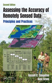 Assessing the accuracy of remotely sensed dataRussell G. Congalton, Kass Green · 1998
 Fundamentals of satellite remote sensingEmilio Chuvieco · 2008
 Computer processing of remotely-sensed imagesPaul M. Mather · 1987
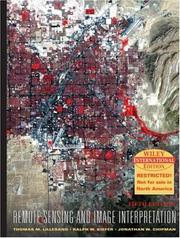 Remote sensing and image interpretationThomas M. Lillesand, Ralph W. Kiefer · 1979
 Introduction to environmental remote sensingEric C. Barrett · 1976
- 📕Mobile RobotsFeitian Zhang, Gerald Cook · 2011
 Sea IceMohammed Shokr, Nirmal Sinha · 2015
 Introduction to remote sensingArthur P. Cracknell, Arthur P. Cracknell · 1991
Ranked by number of editions on Open Library, a rough measure of how lasting a book is.
🔗 Related topics
- Landsat program The Landsat program is the longest-running enterprise that has acquired satellite imagery of Earth. It is a joint NASA / USGS program. On 23 July 1972…
- Operational Land Imager The Operational Land Imager (OLI) is a remote sensing instrument aboard Landsat 8, built by Ball Aerospace & Technologies. Landsat 8 is the successor to…
- Satellite imagery Satellite images (also Earth observation imagery, spaceborne photography, or simply satellite photo) are images of Earth collected by imaging satellites…
- Landsat 8 Landsat 8 is an American Earth observation satellite launched on 11 February 2013. It is the eighth satellite in the Landsat program and the seventh to…
- Remote sensing (oceanography) Remote sensing in oceanography is a widely used observational technique which enables researchers to acquire data of a location without physically measuring…
- Normalized difference vegetation index The normalized difference vegetation index (NDVI) is a widely used metric for quantifying the health and density of vegetation using sensor data. It is…
- Multispectral pattern recognition Multispectral remote sensing is the collection and analysis of reflected, emitted, or back-scattered energy from an object or an area of interest in multiple…
- Thermal remote sensing Thermal remote sensing is a branch of remote sensing in the thermal infrared region of the electromagnetic spectrum. Thermal radiation from ground objects…