Live briefing

Everything about Normalized difference vegetation index
Metric quantifying vegetation density
The normalized difference vegetation index (NDVI) is a widely used metric for quantifying the health and density of vegetation using sensor data. It is calculated from spectrometric data at two specific bands: red and near-infrared. The spectrometric data is usually sourced from remote sensors, such as satellites. Wikipedia →
🧭 Start here: a 6-step reading path
- Read the overview: Normalized difference vegetation indexA 5-minute orientation
- Skim a recent paper: Demystifying normalized difference vegetation index (NDVI) for greenness exposure assessments and policy interventions in urban greeningInfluential work since 2022
- Pick up a classic book: Intelligence BulletinThe most-reprinted book on the subject
- Read the landmark paper: NDWI—A normalized difference water index for remote sensing of vegetation liquid water from spaceCited 5,965 times
- Go sideways: Enhanced vegetation indexA closely related topic
- Go sideways: Vegetation indexA closely related topic
📖 Definitions
No dictionary entry for this exact phrase.
🗂️ The subject at a glance
🏆 Landmark papers (most cited)
NDWI—A normalized difference water index for remote sensing of vegetation liquid water from space
The Normalized Difference Vegetation Index (NDVI): unforeseen successes in animal ecology
Analysis of the dynamics of African vegetation using the normalized difference vegetation index
Relation between the normalized difference vegetation index and ecological variables
Relative sensitivity of normalized difference vegetation Index (NDVI) and microwave polarization difference Index (MPDI) for vegetation and desertification monitoring
Wheat basal crop coefficients determined by normalized difference vegetation index
Analysis of vegetation recovery surrounding a restored wetland using the normalized difference infrared index (NDII) and normalized difference vegetation index (NDVI)
Estimating Rice Grain Yield Potential Using Normalized Difference Vegetation Index
🆕 Influential since 2022
Demystifying normalized difference vegetation index (NDVI) for greenness exposure assessments and policy interventions in urban greening
Spatiotemporally consistent global dataset of the GIMMS Normalized Difference Vegetation Index (PKU GIMMS NDVI) from 1982 to 2022
Shortcomings of the normalized difference vegetation index as an exposure metric
The normalized difference vegetation index (NDVI) of the Zat valley, Marrakech: comparison and dynamics
Assessing Normalized Difference Vegetation Index as a proxy of urban greenspace exposure
📚 Books worth reading
 Intelligence BulletinUnited States. War Department. Military Intelligence Service · 1942
 The history of Detroit and MichiganSilas Farmer · 1884
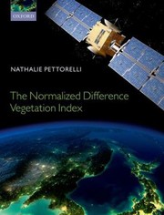 The Normalized Difference Vegetation IndexNathalie Pettorelli · 2013
 Use of the Normalized Difference Vegetation Index to Assess Land Degradation at Multiple ScalesGenesis T. Yengoh, David Dent · 2015
- 📕Use of Normalized Difference Vegetation Index Habitat Models to Predict Breeding Birds on the San Pedro River, ArizonaU.S. Department of the Interior Staff · 2014
- 📕Greenness Products Normalized Difference Vegetation Index (NDVI), 1998, Data Archives, General Technical Report RMRS-GTR-27-CD, April 1999, Set of 5, (CD-ROM) · 1999
- 📕NDVI and derived image dataRobert E. Burgan, Carolyn H. Chase · 1998
- 📕Climate change and sustainable developmentAssociation of Nigerian Geographers. Annual Conference · 2012
Ranked by number of editions on Open Library, a rough measure of how lasting a book is.
🔗 Related topics
- Enhanced vegetation index The enhanced vegetation index (EVI) is an 'optimized' vegetation index designed to enhance the vegetation signal with improved sensitivity in high biomass…
- Vegetation index A vegetation index (VI) is a spectral imaging transformation of two or more image bands designed to enhance the contribution of vegetation properties and…
- Land cover maps Land cover maps are tools that provide vital information about the Earth's land use and land cover patterns. They aid policy development, urban planning…
- Normalized difference red edge index The normalized difference red edge index (NDRE) is a metric that can be used to analyse whether images obtained from multi-spectral image sensors contain…
- Normalized difference water index Normalized difference water index (NDWI) may refer to one of at least two remote sensing-derived indexes related to liquid water: One is used to monitor…
- Soil-adjusted vegetation index Empirically derived NDVI products have been shown to be unstable, varying with soil colour, soil moisture, and saturation effects from high density vegetation…
- Moment distance index The moment distance index (MDI) is a shape-based metric or shape index that can be used to analyze spectral reflectance curves and waveform lidar, proposed…
- Multispectral imaging Multispectral imaging captures image data within specific wavelength ranges across the electromagnetic spectrum. The wavelengths may be separated by filters…