Everything about Map layout
Arrangement of map elements on a page

Map layout, also called map composition or (cartographic) page layout, is the part of cartographic design that involves assembling various map elements on a page. This may include the map image itself, along with titles, legends, scale indicators, inset maps, and other elements. It follows principles similar to page layout in graphic design, such as balance, gestalt, and visual hierarchy. The term map composition is also used for the assembling of features and symbols within the map image itself, which can cause some confusion; these two processes share a few common design principles but are distinct procedures in practice. Similar principles of layout design apply to maps produced in a variety of media, from large format wall maps to illustrations in books to interactive web maps, although each medium has unique constraints and opportunities. Wikipedia →
🧭 Start here: a 6-step reading path
- Read the overview: Map layoutA 5-minute orientation
- Skim a recent paper: How dynamic information layout in GIS interface affects users’ search performance: integrating visual motion cognition into map information designInfluential work since 2022
- Pick up a classic book: Planning profitable neighborhoodsThe most-reprinted book on the subject
- Read the landmark paper: Layout Adjustment and the Mental MapCited 371 times
- Go sideways: Cartographic designA closely related topic
- Go sideways: Visual hierarchyA closely related topic
📖 Definitions
No dictionary entry for this exact phrase.
🗂️ The subject at a glance
🏆 Landmark papers (most cited)
Layout Adjustment and the Mental Map
Flow Map Layout via Spiral Trees
Automatic Metro Map Layout Using Multicriteria Optimization
A Survey on Transit Map Layout – from Design, Machine, and Human Perspectives
Improved Grid Map Layout by Point Set Matching
The effect of color coding and layout coding on users’ visual search on mobile map navigation icons
Travel‐Route‐Centered Metro Map Layout and Annotation
SSMG: Spatial-Semantic Map Guided Diffusion Model for Free-Form Layout-to-Image Generation
🆕 Influential since 2022
How dynamic information layout in GIS interface affects users’ search performance: integrating visual motion cognition into map information design
Development of Autonomous Mobile Robot with 3DLidar Self-Localization Function Using Layout Map
Layout map in facility layout planning: A fuzzy methodology
MapLayNet: map layout representation learning using weakly supervised structure-aware graph neural networks
Shape‐Guided Mixed Metro Map Layout
📚 Books worth reading
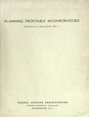 Planning profitable neighborhoodsUnited States. Federal Housing Administration. · 1938
Ranked by number of editions on Open Library, a rough measure of how lasting a book is.
🔗 Related topics
- Cartographic design Cartographic design or map design is the process of crafting the appearance of a map, applying the principles of design and knowledge of how maps are used…
- Visual hierarchy Visual hierarchy, in Gestalt psychology, describes how particular elements in a visual field stand out more than others in a pattern, creating a perceived…
- Map symbol A map symbol or cartographic symbol is a graphical device used to visually represent a real-world feature on a map, working in the same fashion as other…
- Visual variable A visual variable, in cartographic design, graphic design, and data visualization, is an aspect of a graphical object that can visually differentiate it…
- Typography (cartography) Typography, as an aspect of cartographic design, is the craft of designing and placing text on a map in support of the map symbols, together representing…
- Cartographic generalization Cartographic generalization, or map generalization, includes all changes in a map that are made when one derives a smaller-scale map from a larger-scale…
- Figure-ground (cartography) Figure-ground contrast, in the context of map design, is a property of a map in which the map image can be partitioned into a single feature or type of…
- Map In cartography, a map is a representation or abstraction of geographic reality. Maps are used for a wide range of purposes, including navigation, scientific…