Everything about Computer cartography
Compiling data to create a visual image

Computer cartography is the art, science, and technology of making and using maps with a computer. This technology represents a paradigm shift in how maps are produced, but is still fundamentally a subset of traditional cartography. The primary function of this technology is to produce maps, including creation of accurate representations of a particular area such as, detailing major road arteries and other points of interest for navigation, and in the creation of thematic maps. Computer cartography is one of the main functions of geographic information systems (GIS), however, GIS is not necessary to facilitate computer cartography and has functions beyond just making maps. The first peer-reviewed publications on using computers to help in the cartographic process predate the introduction of full GIS by several years. Wikipedia →
🧭 Start here: a 6-step reading path
- Read the overview: Computer cartographyA 5-minute orientation
- Skim a recent paper: Preserving the History of Computer Cartography at the Library of CongressInfluential work since 2022
- Pick up a classic book: Advances in Mobile Mapping TechnologyThe most-reprinted book on the subject
- Read the landmark paper: Computer cartography point-in-polygon programsCited 44 times
- Go sideways: MapA closely related topic
- Go sideways: Internet GISA closely related topic
📖 Definitions
No dictionary entry for this exact phrase.
🗂️ The subject at a glance
🏆 Landmark papers (most cited)
Computer cartography point-in-polygon programs
SOME APPLICATIONS OF COMPUTER CARTOGRAPHY TO THE STUDY OF COGNITIVE CONFIGURATIONS
Converging Themes in Cartography and Computer Games
Computer-Aided Cartography
KOMPLOT "Do-it-yourself" Computer Cartography
Computer Assisted Cartography: Graphics or Geometry?
HYDROLOGY AND COMPUTER MAPPING: Stream Networks And Digital Cartography
GIMMS / AN EXAMPLE OF AN OPERATIONAL SYSTEM FOR COMPUTER CARTOGRAPHY
🆕 Influential since 2022
📚 Books worth reading
 Advances in Mobile Mapping TechnologyJonathan Li · 2007
 Theory of CryptographyYevgeniy Dodis, Jesper Buus Nielsen · 2015
 MappingJeremy Crampton, Jeremy W. Crampton · 2009
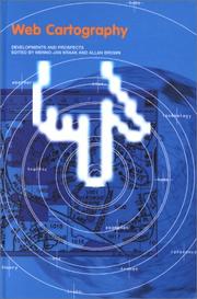 Web cartographyAllan Brown, Jan-Menno Kraak · 2000
 Learning QGISAnita Graser · 2014
- 📕Never lost againBill Kilday · 2018
- 📕Bibliography and IndexLibrary for Computer Graphics & Spatial Analysis · 1981
- 📕Management's Use of MapsLibrary for Computer Graphics & Spatial Analysis · 1979
Ranked by number of editions on Open Library, a rough measure of how lasting a book is.
🔗 Related topics
- Map In cartography, a map is a representation or abstraction of geographic reality. Maps are used for a wide range of purposes, including navigation, scientific…
- Internet GIS Internet GIS is broad set of technologies and applications that employ the Internet to access, analyze, visualize, and distribute spatial data via geographic…
- Mobile mapping Mobile mapping is the process of collecting geospatial data from a mobile vehicle, typically fitted with a range of GNSS, photogrammetric, radar, lidar…
- Waldo R. Tobler Waldo Rudolph Tobler (November 16, 1930 – February 20, 2018) was an American-Swiss geographer and cartographer. Tobler is regarded as one of the most influentia…
- Geographic information system A geographic information system (GIS) consists of integrated computer hardware and software that store, manage, analyze, edit, output, and visualize geographic…
- Automotive navigation system An automotive navigation system is part of the automobile controls or a third party add-on used to find direction in an automobile. It typically uses a…
- Cartography Cartography (/kɑːrˈtɒɡrəfi/) is the study and practice of making and using maps. Combining science, aesthetics and technique, cartography builds on the…
- Geodetic datum A geodetic datum or geodetic system (also: geodetic reference datum, geodetic reference system, or geodetic reference frame, or terrestrial reference frame)…