Live briefing
Everything about Collaborative mapping
Aggregation of web mapping and user content
Collaborative mapping, also known as citizen mapping, is the aggregation of Web mapping and user-generated content, from a group of individuals or entities, and can take several distinct forms. With the growth of technology for storing and sharing maps, collaborative maps have become competitors to commercial services, in the case of OpenStreetMap, or components of them, as in Google Map Maker, Waze and Yandex Map Editor. Wikipedia →
🧭 Start here: a 6-step reading path
- Read the overview: Collaborative mappingA 5-minute orientation
- Skim a recent paper: Energy-Efficient Ground Traversability Mapping Based on UAV-UGV Collaborative SystemInfluential work since 2022
- Pick up a classic book: Mapping and the Citizen SensorThe most-reprinted book on the subject
- Read the landmark paper: AgriColMap: Aerial-Ground Collaborative 3D Mapping for Precision FarmingCited 99 times
- Go sideways: Volunteered geographic informationA closely related topic
- Go sideways: NeogeographyA closely related topic
📖 Definitions
No dictionary entry for this exact phrase.
🏆 Landmark papers (most cited)
AgriColMap: Aerial-Ground Collaborative 3D Mapping for Precision Farming
Collaborative Concept Mapping: Provoking and Supporting Meaningful Discourse
Collaborative Semantic Understanding and Mapping Framework for Autonomous Systems
Mapping Collaborative Work and Innovation in Biomedicine
Ground and Aerial Collaborative Mapping in Urban Environments
Learning processes and collaborative concept mapping
Adaptive gamification in Collaborative systems, a systematic mapping study
Emerging conflict in collaborative mapping: Towards a deeper understanding?
🆕 Influential since 2022
Energy-Efficient Ground Traversability Mapping Based on UAV-UGV Collaborative System
Collaborative Mobile Robotics for Semantic Mapping: A Survey
MACIM: Multi-Agent Collaborative Implicit Mapping
Mapping primary students’ mobile collaborative inquiry-based learning behaviours in science collaborative problem solving via learning analytics
Mapping Pediatric Oncology Clinical Trial Collaborative Groups on the Global Stage
📚 Books worth reading
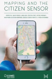 Mapping and the Citizen SensorGiles Foody, Linda See · 2017
 European Handbook of Crowdsourced Geographic InformationCristina Capineri, Muki Haklay · 2016
Ranked by number of editions on Open Library, a rough measure of how lasting a book is.
🔗 Related topics
- Volunteered geographic information Volunteered geographic information (VGI) is the harnessing of tools to create, assemble, and disseminate geographic data provided voluntarily by individuals…
- Neogeography Neogeography (literally "new geography") is the use of geographical techniques and tools for personal and community activities or by a non-expert group…
- Web mapping Web mapping or online mapping is the process of using, creating, and distributing maps on the World Wide Web (the Web), usually through the use of Web…
- OpenStreetMap OpenStreetMap (OSM) is a map database maintained by a community of volunteers via open collaboration. Contributors collect data from surveys, trace from…
- Geographic information system software A GIS software program is a computer program to support the use of a geographic information system, providing the ability to create, store, manage, query…
- Geographic information system A geographic information system (GIS) consists of integrated computer hardware and software that store, manage, analyze, edit, output, and visualize geographic…
- WorldMap WorldMap is a web platform for creating, displaying, analyzing, and searching spatial data and other data forms across multiple disciplines. WorldMap is…
- Crisis mapping Crisis mapping (also known as disaster mapping) is the real-time gathering, display and analysis of data during a crisis, usually a natural disaster or…