Everything about Spatial analysis
Techniques to study geometric data

Spatial analysis is any of the formal techniques which study entities using their topological, geometric, or geographic properties, primarily used in urban design. Spatial analysis includes a variety of techniques using different analytic approaches, especially spatial statistics. It may be applied in fields as diverse as astronomy, with its studies of the placement of galaxies in the cosmos, or to chip fabrication engineering, with its use of "place and route" algorithms to build complex wiring structures. In a more restricted sense, spatial analysis is geospatial analysis, the technique applied to structures at the human scale, most notably in the analysis of geographic data. It may also applied to genomics, as in transcriptomics data, but is primarily for spatial data. Wikipedia →
🧭 Start here: a 6-step reading path
- Read the overview: Spatial analysisA 5-minute orientation
- Skim a recent paper: Squidpy: a scalable framework for spatial omics analysisInfluential work since 2022
- Pick up a classic book: Adjustment computationsThe most-reprinted book on the subject
- Read the landmark paper: Google Earth Engine: Planetary-scale geospatial analysis for everyoneCited 13,712 times
- Go sideways: Modifiable areal unit problemA closely related topic
- Go sideways: Boundary problem (spatial analysis)A closely related topic
📖 Definitions
No dictionary entry for this exact phrase.
🗂️ The subject at a glance
🏆 Landmark papers (most cited)
Google Earth Engine: Planetary-scale geospatial analysis for everyone
GIS, spatial analysis and spatial statistics
Spatial Liquefaction Analysis System
Spatial analysis for epidemiology
Exploratory Spatial Data Analysis
Spatial dynamic factor analysis
Spatial Analysis of Fire
Spatial Data Analysis
🆕 Influential since 2022
Squidpy: a scalable framework for spatial omics analysis
Spatial Transcriptomics for Tumor Heterogeneity Analysis
Differential gene expression analysis of spatial transcriptomic experiments using spatial mixed models
Landslide spatial prediction using cluster analysis
Intracellular spatial transcriptomic analysis toolkit (InSTAnT)
📚 Books worth reading
 Adjustment computationsCharles D. Ghilani · 2008
 Advances in spatio-temporal analysisWolfgang Kainz · 2006
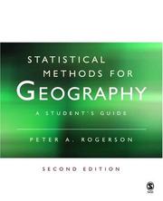 Statistical Methods for GeographyPeter A. Rogerson · 2001
 Statistical methods for spatial data analysisOliver Schabenberger, Carol A. Gotway · 2004
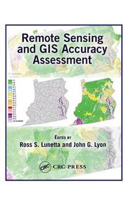 Remote sensing and GIS accuracy assessmentRoss S. Lunetta, J. G. Lyon · 2004
 Spatial Econometrics using MicrodataJean Dubé, Diègo Legros · 2014
- 📕Spatial Microsimulation with RRobin Lovelace · 2016
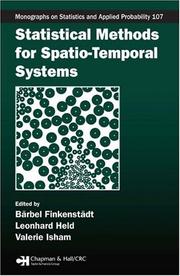 Statistical methods for spatio-temporal systemsLeonhard Held · 2006
Ranked by number of editions on Open Library, a rough measure of how lasting a book is.
🔗 Related topics
- Modifiable areal unit problem The modifiable areal unit problem (MAUP) is a source of statistical bias that can significantly impact the results of statistical hypothesis tests. The…
- Boundary problem (spatial analysis) A boundary problem in analysis is a phenomenon in which geographical patterns are differentiated by the shape and arrangement of boundaries that are drawn…
- Moran's I In statistics, Moran's I is a measure of spatial autocorrelation developed by Patrick Alfred Pierce Moran. Spatial autocorrelation is characterized by…
- Field (geography) In the context of spatial analysis, geographic information systems, and geographic information science, a field is a property that fills space, and varies…
- Geographic information system A geographic information system (GIS) consists of integrated computer hardware and software that store, manage, analyze, edit, output, and visualize geographic…
- Transport network analysis A transport network, or transportation network, is a network or graph in geographic space, describing an infrastructure that permits and constrains movement…
- GIS and public health Geographic information systems (GISs) and geographic information science (GIScience) combine computer-mapping capabilities with additional database management…
- Proximity analysis Proximity analysis is a class of spatial analysis tools and algorithms that employ geographic distance as a central principle. Distance is fundamental…