Live briefing
Everything about Spatial database
Database of data representing objects in geometric space
A spatial database is a general-purpose database that has been enhanced to include spatial data that represents objects defined in a geometric space, along with tools for querying and analyzing such data. Wikipedia →
🧭 Start here: a 6-step reading path
- Read the overview: Spatial databaseA 5-minute orientation
- Skim a recent paper: STOmicsDB: a comprehensive database for spatial transcriptomics data sharing, analysis and visualizationInfluential work since 2022
- Pick up a classic book: Geographic Information Systems to Spatial Data InfrastructuresThe most-reprinted book on the subject
- Read the landmark paper: An introduction to spatial database systemsCited 355 times
- Go sideways: PostGISA closely related topic
- Go sideways: Simple FeaturesA closely related topic
📖 Definitions
No dictionary entry for this exact phrase.
🗂️ The subject at a glance
🏆 Landmark papers (most cited)
An introduction to spatial database systems
On spatial database integration
Database organization strategies for spatial decision support systems
Aquila: a spatial omics database and analysis platform
Spatial data extension for Cassandra NoSQL database
Spatial Database of Planted Trees (SDPT Version 2.0)
Spatial database of planted forests in East Asia
EigenScape: A Database of Spatial Acoustic Scene Recordings
🆕 Influential since 2022
STOmicsDB: a comprehensive database for spatial transcriptomics data sharing, analysis and visualization
A single-cell and spatial RNA-seq database for Alzheimer’s disease (ssREAD)
Gridded livestock density database and spatial trends for Kazakhstan
A worldwide epidemiological database for COVID-19 at fine-grained spatial resolution
A neural database for differentially private spatial range queries
📚 Books worth reading
- 📕Geographic Information Systems to Spatial Data InfrastructuresIan Masser · 2019
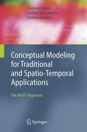 Conceptual modeling for traditional and spatio-temporal applicationsChristine Parent, Stefano Spaccapietra · 2006
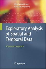 Exploratory analysis of spatial and temporal dataNatalia Andrienko, Gennady Andrienko · 2005
 Spatial Database for GPS Wildlife Tracking DataFerdinando Urbano, Francesca Cagnacci · 2014
 Computing with spatial trajectoriesYu Zheng, Xiaofang Zhou · 2011
- 📕PostGIS CookbookPaolo Corti, Thomas J. Kraft · 2014
 Spatial data managementNikos Mamoulis · 2011
 Beginning spatial with SQL server 2008Alastair Aitchison · 2009
Ranked by number of editions on Open Library, a rough measure of how lasting a book is.
🔗 Related topics
- PostGIS PostGIS (/ˈpoʊstdʒɪs/ POST-jis) is an open source software program that adds support for geographic objects to the PostgreSQL object-relational database…
- Simple Features Simple Features (officially Simple Feature Access) is a set of standards that specify a common storage and access model of geographic features made of…
- GeoSPARQL GeoSPARQL is a model for representing and querying geospatial linked data for the Semantic Web. It is standardized by the Open Geospatial Consortium as…
- Oracle Spatial and Graph Oracle Spatial and Graph, formerly Oracle Spatial, is a free option component of the Oracle Database. The spatial features in Oracle Spatial and Graph…
- GIS file format A GIS file format or geospatial file format is a standard for encoding geographical information into a computer file. It is a specialized type of file…
- Geographic information system software A GIS software program is a computer program to support the use of a geographic information system, providing the ability to create, store, manage, query…
- JTS Topology Suite JTS Topology Suite (Java Topology Suite) is an open-source Java software library that provides an object model for Euclidean planar linear geometry together…
- Geodatabase (Esri) A Geodatabase is a proprietary GIS file format developed in the late 1990s by Esri (a GIS software vendor) to represent, store, and organize spatial datasets…