🧭 Start here: a 6-step reading path
- Read the overview: GeowebA 5-minute orientation
- Skim a recent paper: Géoweb de narration et de modélisation : la plateforme NAMO GeoWebInfluential work since 2022
- Pick up a classic book: Geography mark-up languageThe most-reprinted book on the subject
- Read the landmark paper: Web Mapping 2.0: The Neogeography of the GeoWebCited 402 times
- Go sideways: Geographic information system softwareA closely related topic
- Go sideways: Digital EarthA closely related topic
📖 Definitions
No dictionary entry for this exact phrase.
🗂️ The subject at a glance
🏆 Landmark papers (most cited)
Web Mapping 2.0: The Neogeography of the GeoWeb
Beyond the geotag: situating ‘big data’ and leveraging the potential of the geoweb
GeoWeb and crisis management: issues and perspectives of volunteered geographic information
Gender and the GeoWeb: divisions in the production of user-generated cartographic information
Privacy, reconsidered: New representations, data practices, and the geoweb
Situating the geoweb in political economy
Christaller and “big data”: recalibrating central place theory via the geoweb
Public participation in the Geoweb era: Defining a typology for geo-participation in local governments
🆕 Influential since 2022
📚 Books worth reading
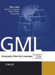 Geography mark-up languageRon Lake, David Burggraf · 2004
 geo@webInga Gryl, Tobias Nehrdich · 2012
 Geographic information systems and sciencePaul Longley · 2001
- 📕GeoWebRon Lake · 2011
- 📕Evaluation of the GEOWEB and J.K. STRUCTURE slope stabilization methodsJoe Wilson · 2000
 Beginning Google Maps mashups with mapplets, KML and GeoRSSSterling Udell · 2009
- 📕Map librarianshipSusan Ward Aber · 2017
Ranked by number of editions on Open Library, a rough measure of how lasting a book is.
🔗 Related topics
- Geographic information system software A GIS software program is a computer program to support the use of a geographic information system, providing the ability to create, store, manage, query…
- Digital Earth Digital Earth is the name given to a concept by former US vice president Al Gore in 1998, describing a virtual representation of the Earth that is georeferenced…
- Address geocoding Address geocoding, or simply geocoding, is the process of taking a text-based description of a location, such as an address or the name of a place, and…
- Distributed GIS Distributed GIS refers to GI Systems that do not have all of the system components in the same physical location. This could be the processing, the database…
- Neogeography Neogeography (literally "new geography") is the use of geographical techniques and tools for personal and community activities or by a non-expert group…
- Toponym resolution In geographic information systems, toponym resolution is the relationship process between a toponym, i.e. the mention of a place, and an unambiguous spatial…
- Web GIS Web GIS, also known as Web-based GIS, are Geographic Information Systems (GIS) that employ the World Wide Web (the Web) to facilitate the storage, visualization…
- Geographic information system A geographic information system (GIS) consists of integrated computer hardware and software that store, manage, analyze, edit, output, and visualize geographic…