Everything about Geological modelling
Applied science of creating computerized representations of portions of the Earth's crust

Geological modelling, geologic modelling or geomodelling is the applied science of creating computerized representations of portions of the Earth's crust based on geophysical and geological observations made on and below the Earth surface. A geomodel is the numerical equivalent of a three-dimensional geological map complemented by a description of physical quantities in the domain of interest. Geomodelling is related to the concept of Shared Earth Model; which is a multidisciplinary, interoperable and updatable knowledge base about the subsurface. Wikipedia →
🧭 Start here: a 6-step reading path
- Read the overview: Geological modellingA 5-minute orientation
- Skim a recent paper: 3D geological modelling of the Bologna urban area (Italy)Influential work since 2022
- Pick up a classic book: Geochemical and Biogeochemical Reaction ModelingThe most-reprinted book on the subject
- Read the landmark paper: Geological modelling from field data and geological knowledgeCited 460 times
- Go sideways: Reservoir modelingA closely related topic
- Go sideways: ViridienA closely related topic
📖 Definitions
No dictionary entry for this exact phrase.
🗂️ The subject at a glance
🏆 Landmark papers (most cited)
Geological modelling from field data and geological knowledge
Geological modelling from field data and geological knowledge
Challenges and trends for geological modelling and visualisation
Nested geological modelling of naturally fractured reservoirs
Three-dimensional geological modelling of potential-field data
Geological modelling of clay diagenesis in sandstones
Subsurface geological-geotechnical modelling to sustain underground civil planning
LoopStructural 1.0: time-aware geological modelling
🆕 Influential since 2022
3D geological modelling of the Bologna urban area (Italy)
Modelling geological CO2 leakage: Integrating fracture permeability and fault zone outcrop analysis
GeoINR 1.0: an implicit neural network approach to three-dimensional geological modelling
Evaluating the chain of uncertainties in the 3D geological modelling workflow
Geological realism in Fluvial facies modelling with GAN under variable depositional conditions
📚 Books worth reading
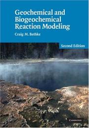 Geochemical and Biogeochemical Reaction ModelingCraig M. Bethke · 2007
- 📕Techniques for Virtual PalaeontologyMark Sutton, Imran Rahman · 2013
- 📕Applied Geostatistics with SGeMSNicolas Remy, Alexandre Boucher · 2009
- 📕Multiple-Point GeostatisticsGregoire Mariethoz, Jef Caers · 2014
 Geomechanical modelling in engineering practiceJ. A. Studer · 1986
 3D Geoscience ModelingSimon Houlding · 1994
 Geologic Modeling and MappingAndrea Förster, Daniel F. Merriam · 2011
 SubductionAlexander I. Shemenda · 1994
Ranked by number of editions on Open Library, a rough measure of how lasting a book is.
🔗 Related topics
- Reservoir modeling In the oil and gas industry, reservoir modeling involves the construction of a computer model of a petroleum reservoir, for the purposes of improving estimation…
- Viridien Viridien (VIRI), formerly CGG, is a multinational technology, digital and Earth data company, specializing in solving complex natural resource, energy…
- Seismic inversion In geophysics (primarily in oil-and-gas exploration/development), seismic inversion is the process of transforming seismic reflection data into a quantitative…
- Magnetotellurics Magnetotellurics (MT) is an electromagnetic geophysical method for inferring the Earth's subsurface electrical conductivity from measurements of natural…
- European Association of Geoscientists and Engineers The European Association of Geoscientists and Engineers (EAGE) is a professional organization for geoscientists and engineers, established in 1951 with…
- Geothermal exploration Geothermal exploration is the exploration of the subsurface in search of viable active geothermal regions with the goal of building a geothermal power…
- Geostatistics Geostatistics is a branch of statistics focusing on spatial or spatiotemporal datasets. Developed originally to predict probability distributions of ore…
- Andre G. Journel André Georges Journel is a French American engineer who excelled in formulating and promoting geostatistics in the earth sciences and engineering, first…