Everything about GDAL
Translator library for raster and vector geospatial data formats

The Geospatial Data Abstraction Library (GDAL) is a computer software library for reading and writing raster and vector geospatial data formats, and is released under the permissive X/MIT style free software license by the Open Source Geospatial Foundation. As a library, it presents a single abstract data model to the calling application for all supported formats. It may also be built with a variety of useful command line interface utilities for data translation and processing. Projections and transformations are supported by the PROJ library. Wikipedia →
🧭 Start here: a 6-step reading path
- Read the overview: GDALA 5-minute orientation
- Skim a recent paper: Ratiometric optical thermometry based on a Dy 3+ , Eu 3+ co-doped GdAl 3 (BO 3 ) 4 phosphorInfluential work since 2022
- Pick up a classic book: Web Mapping IllustratedThe most-reprinted book on the subject
- Read the landmark paper: Scaling of Nonlinear Susceptibility in MnCu and GdAl Spin-GlassesCited 159 times
- Go sideways: Open Source Geospatial FoundationA closely related topic
- Go sideways: GIS file formatA closely related topic
📖 Definitions
No dictionary entry for this exact phrase.
🗂️ The subject at a glance
🏆 Landmark papers (most cited)
Scaling of Nonlinear Susceptibility in MnCu and GdAl Spin-Glasses
GDAL/OGR and Geospatial Data IO Libraries
Magnetocaloric Effects and the Angular Variation of the Magnetic Phase Diagram of Antiferromagnetic GdAlO3
Properties of GdAlO3near the Spin-Flop Bicritical Point
Bicritical and Tetracritical Behavior of GdAlO3
Antiferromagnetism and the Magnetic Phase Diagram of GdAlO3
Spin-glass behavior of mechanically milled crystallineGdAl2
Open and scalable analytics of large Earth observation datasets: From scenes to multidimensional arrays using SciDB and GDAL
🆕 Influential since 2022
Ratiometric optical thermometry based on a Dy 3+ , Eu 3+ co-doped GdAl 3 (BO 3 ) 4 phosphor
GDAL and PROJ Libraries Integrated with GRASS GIS for Terrain Modelling of the Georeferenced Raster Image
Enhanced red luminescence from GdAl3(BO3)4: Pr3+ phosphors under NUV excitation
Complex magnetic transitions in the triangular net compound GdAl 2 Ge 2
Streamlining land surface model Initialization: Automated data retrieval for VELMA using HMS REST API and GDAL
📚 Books worth reading
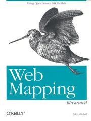 Web Mapping IllustratedTyler Mitchell · 2005
 Geospatial Power Tools - GDAL Raster & Vector CommandsTyler Mitchell · 2015
Ranked by number of editions on Open Library, a rough measure of how lasting a book is.
🔗 Related topics
- Open Source Geospatial Foundation The Open Source Geospatial Foundation (OSGeo), is a non-profit non-governmental organization whose mission is to support and promote the collaborative…
- GIS file format A GIS file format or geospatial file format is a standard for encoding geographical information into a computer file. It is a specialized type of file…
- GeoTIFF GeoTIFF is a public domain metadata standard which allows georeferencing information to be embedded within a TIFF file. The potential additional information…
- SpatiaLite SpatiaLite is a spatial extension to SQLite, providing vector geodatabase functionality. It is similar to PostGIS, Oracle Spatial, and SQL Server with…
- QGIS QGIS is a free and open-source geographic information system (GIS) software. QGIS supports Linux, macOS, and Windows. It supports viewing, editing, printing…
- Shapefile The shapefile format is a geospatial vector data format for geographic information system (GIS) software. It is developed and regulated by Esri as a mostly…
- Geographic information system software A GIS software program is a computer program to support the use of a geographic information system, providing the ability to create, store, manage, query…
- Sol Katz Solomon 'Sol' Katz (August 3, 1947 – April 23, 1999) was an American software developer who pioneered geospatial computer software (a sub-category of GIS)…