Everything about Digital Earth Reference Model
The term Digital Earth Reference Model (DERM) was coined by Tim Foresman in context with a vision for an all encompassing geospatial platform as an abstract for information flow in support of Al Gore's vision for a Digital Earth. The Digital Earth reference model seeks to facilitate and promote the use of georeferenced information from multiple sources over the Internet. A digital Earth reference model defines a fixed global reference frame for the Earth using four principles of a digital system, namely:Discrete partitioning using regular or irregular cell mesh, tiling or Grid; Data acquisition using signal processing theory for assigning binary values from continuous analog or other digital sources to the discrete cell partitions; An ordering or naming of cells that can provide both unique spatial indexing and geographic location address; A set of mathematical operations built on the indexing for algebraic, geometric, Boolean and image processing transforms, etc. Wikipedia →
🧭 Start here: a 6-step reading path
- Read the overview: Digital Earth Reference ModelA 5-minute orientation
- Pick up a classic book: Computer NetworksThe most-reprinted book on the subject
- Go sideways: Digital EarthA closely related topic
- Go sideways: Discrete global gridA closely related topic
📖 Definitions
No dictionary entry for this exact phrase.
🗂️ The subject at a glance
🏆 Landmark papers (most cited)
- No matching papers found.
📚 Books worth reading
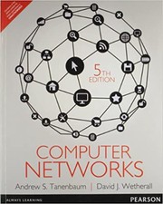 Computer NetworksAndrew S. Tanenbaum, John David Wetherall · 1981
 Earth observation for biodiversity monitoringCristina Secades · 2014
 The Human Planet · 2009
 A TOUR OF THE WORLDMalik Mansab Khan, Muhammad Rafique Abdul Aziz · 2025
Ranked by number of editions on Open Library, a rough measure of how lasting a book is.
🔗 Related topics
- Digital Earth Digital Earth is the name given to a concept by former US vice president Al Gore in 1998, describing a virtual representation of the Earth that is georeferenced…
- Discrete global grid A discrete global grid (DGG) is a mosaic that covers the entire Earth's surface. Mathematically it is a space partitioning: it consists of a set of non-empty…
- Geocode A geocode or geographic identifier (sometimes shortened as geo ID) is a code or unique identifier that represents a geographic entity (location or object)…
- GIS file format A GIS file format or geospatial file format is a standard for encoding geographical information into a computer file. It is a specialized type of file…
- Spatial reference system A spatial reference system (SRS) or coordinate reference system (CRS) is a framework used to precisely measure locations on, or relative to, the surface…
- Grid Look up grid or GRID in Wiktionary, the free dictionary. Grid, The Grid, or GRID may refer to: Regular grid, a tessellation of space with translational…
- Global Navigation Grid Code The Global Navigation Grid Code (GNGC) is a Chinese-developed point reference system designed for global navigation. It is similar in design to national…
- Grid (spatial index) In the context of a spatial index, a grid or mesh is a regular[citation needed] tessellation of a manifold or 2-D surface that divides it into a series…